Beyond the Blue: Papahānaumokuākea Mapping

(EX2403, EX2404, EX2501)

A Journey on NOAA Ship Okeanos Explorer

Sarah Hutchinson
Astrid Zapata-De Jesus

Meet Sarah Hutchinson and Astrid Zapata-De Jesus, Explorers-in-Training on the Beyond the Blue: Papahānaumokuākea Mapping 3 expedition. Follow along as they share their adventures on NOAA Ship Okeanos Explorer to map the deep waters of Papahānaumokuākea Marine National Monument.


Wednesday, November 13, 2024

Explorer-in-training Sarah Hutchinson provides a reflection based on her recent experience on the Beyond the Blue: Papahānaumokuākea Mapping 3 expedition. NOAA Ship Okeanos Explorer arrived in port in Honolulu yesterday to close out work in 2024!
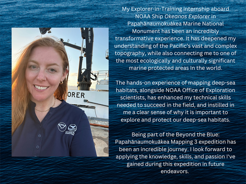
A woman in a navy NOAA polo stands in front of a ship with ocean and sky background. Text and NOAA logo are on the right. Transcribed Text: My Explorer-in-Training internship aboard NOAA Ship Okeanos Explorer in Papahānaumokuākea Marine National Monument has been an incredibly transformative experience. It has deepened my understanding of the Pacific’s vast and complex topography, while also connecting me to one of the most ecologically and culturally significant marine protected areas in the world. The hands-on experience of mapping deep-sea habitats, alongside NOAA Office of Exploration scientists, has enhanced my technical skills needed to succeed in the field, and instilled in me a clear sense of why it is important to explore and protect our deep-sea habitats. Being part of the Beyond the Blue: Papahānaumokuākea Mapping 3 expedition has been an incredible journey. I look forward to applying the knowledge, skills, and passion I've gained during this expedition in future endeavors.
Image courtesy of Sarah Hutchinson. Download largest version (png, 1.92 MB).

Thursday, November 7, 2024

We want to extend a big thank you to the dedicated NOAA Corps officers aboard NOAA Ship Okeanos Explorer!
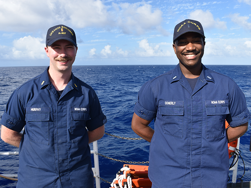
Two NOAA Corps officers standing on a ship's deck with the ocean in the background.
NOAA Corps officers Lieutenant Junior Grade (LTJG) Carrington S. Conerly and Ensign (ENS) Aidan Murphy on the deck of NOAA Ship Okeanos Explorer. Image courtesy of Sarah Hutchinson. Download largest version (jpg, 7.5 MB).
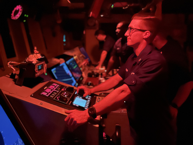
Person in uniform operating a control panel in a dimly lit, red-lit room.
Ensign (ENS) Nicholas Edmundson staffs the bridge of NOAA Ship Okeanos Explorer. Image courtesy of Sarah Hutchinson. Download largest version (jpg, 3.3 MB).
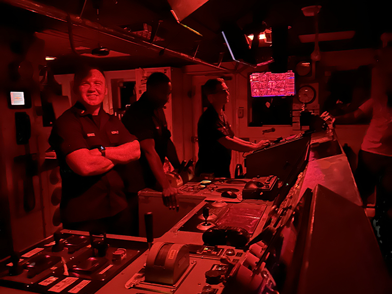
Four people in a dimly lit ship control room under red lighting, engaging with control consoles and instruments.
Ensign (ENS) Cullen Hauck and fellow NOAA Corps officers on the bridge of NOAA Ship Okeanos Explorer. Image courtesy of Sarah Hutchinson. Download largest version (jpg, 3 MB).

Their hard work and unwavering commitment keep us safe every day as we explore the depths of the ocean. From navigating us to our survey areas to conducting safety drills, including fire, abandon ship, and man overboard, their vigilance ensures our team is always prepared.

We’re incredibly grateful for their expertise and professionalism, sailing day and night to make each expedition a success. Their efforts truly make all the difference, and we couldn't do this work without them!


Wednesday, November 6, 2024

Celebrating Lonoikamakahiki (Hawaiian New Year) aboard NOAA Ship Okeanos Explorer! This November, our cultural liaisons, Kelsie Pīkake Kuniyoshi and Kalauʻihilani Robins, guided us in the art of lei making. These beautiful creations, crafted from flowers, leaves, and more, symbolize Aloha — love, friendship, and honor.
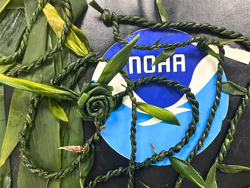
NOAA logo surrounded by braided green leaves and a plant rosette.
Various lei made by the team on NOAA Ship Okeanos Explorer during the Beyond the Blue: Papahānaumokuākea Mapping 3 expedition. Image courtesy of Astrid Zapata-De Jesus. Download largest version (png, 2.18 MB).
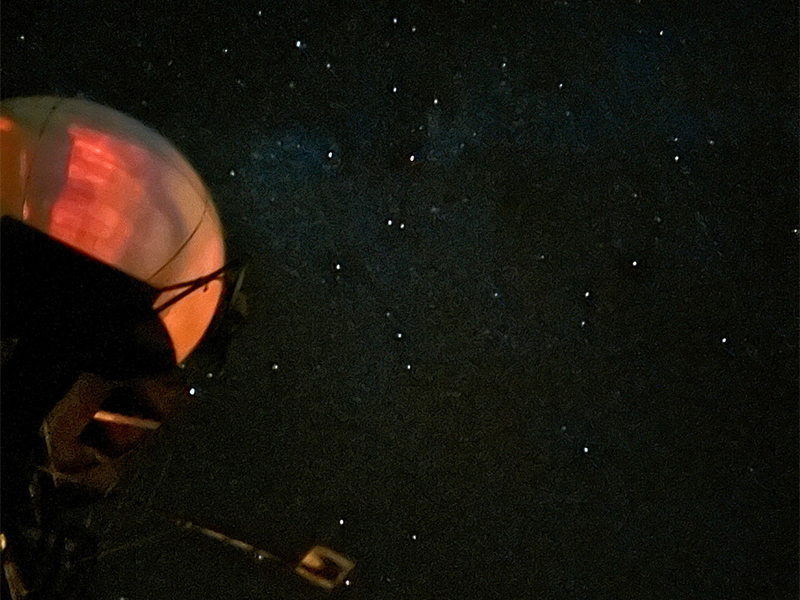
Dome-shaped structure with a reddish glow against a starry night sky.
A sky full of stars viewed from the deck of NOAA Ship Okeanos Explorer during the Beyond the Blue: Papahānaumokuākea Mapping 3 expedition. Image courtesy of Astrid Zapata-De Jesus. Download largest version (png, 1.89 MB).

We also spent time stargazing and spotted Ke Kā o Makaliʻi, the Hawaiian constellation known as 'the Bailer of Makaliʻi. During Hoʻoilo (the Hawaiian winter), these stars light up the night sky, just as they once guided Polynesian voyagers across the vast Pacific.


Tuesday, November 5, 2024

That extra hour of snooze, thanks to the end of daylight savings time? Hawaiian monk seal approved!
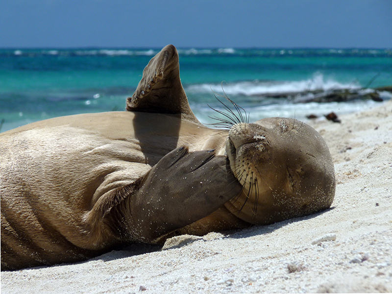
Monk seal resting on a sandy beach with ocean in the background.
The enigmatic Hawaiian monk seal, resting on a sandy shoreline. Image courtesy of NOAA Fisheries Hawaiian Monk Seal Research Program (2014), Mark Sullivan. Download largest version (jpg, 7.18 MB).

What do Hawaiian monk seals have to do with ocean exploration? Why does exploring the ocean matter?

Exploring the ocean reveals not just its wonders but also its vital connections to the entire ecosystem! In 2016, scientists discovered four new species of algae in waters around Hawaiʻi at depths of 60-120 meters (200-400 feet). These unique species, collected during NOAA surveys, support endangered Hawaiian monk seals, who rely on the ʻĪliohāhā algae for foraging in their homes in the Hawaiian archipelago.
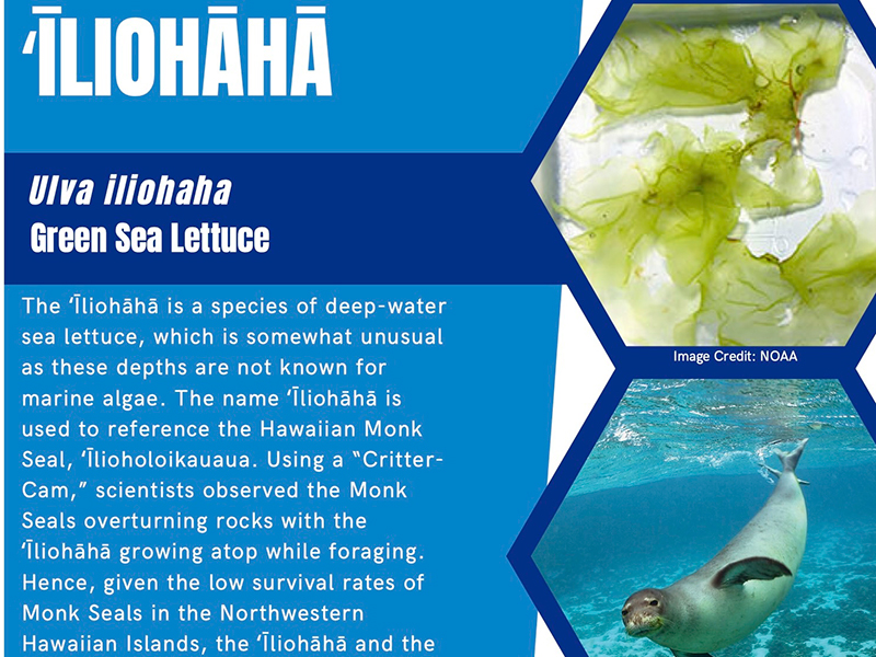
Poster about ʻĪliohāhā sea lettuce with images of sea lettuce and a Hawaiian Monk Seal.
ʻĪliohāhā is a recently discovered species of algae that is an important part of the ecosystem that Hawaiian monk seals call home. Image courtesy of Papahānaumokuākea Native Hawaiian Cultural Working Group, Kelsie Pīkake Kuniyoshi. Download largest version (jpg, 1.02 MB).
Mechanical arm underwater holding green seaweed near a segmented container.
A new species of algae, Ulva ohiohilulu, is collected west of Maui by a Hawaiʻi Undersea Research Laboratory submersible at 93 meters (304 feet) depth. Image courtesy of the HURL archives. Download largest version (jpg, 311 KB).

Fun fact from the State of Hawai‘i Division of Aquatic Resources: “Hawaiian monk seals spend about one third of their time resting on land…”

Learn more about Hawaiian monk seals from NOAA Fisheries.

Monday, November 4, 2024
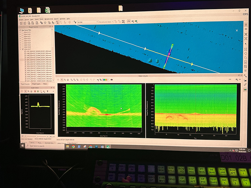
Computer screen displaying sonar data analysis software with maps and graphs.
Multibeam data displayed on a computer screen in the mission control room of NOAA Ship Okeanos Explorer during the Beyond the Blue: Papahānaumokuākea Mapping 3 expedition. Image courtesy of Dan Freitas. Download largest version (jpg, 5.11 MB).

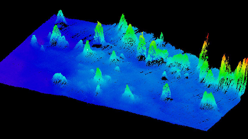
As explorers-in-training, we spend our days in the mission control room on NOAA Ship Okeanos Explorer. Multibeam sonar data is collected and imported into our software. We are responsible for making sure incoming data accurately represents the true seafloor. This includes monitoring sonar acquisition, defining instrument and sounds speed processing settings, and cleaning multibeam raw point cloud data. These processed data are turned into standardized mapping products that are sent to shore at the end of each day. Additionally, we launch expendable bathythermographs (XBTs) to determine the ocean’s temperature, which helps us determine the overall sound profile.
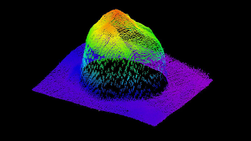
A colorful 3D plot of a mountain-like structure on a black background with a gradient spectrum from red at the peak to purple at the base.
Examples of point clouds of features mapped during the Beyond the Blue: Papahānaumokuākea Mapping 3 expedition, generated from acoustic data collected via multibeam echosounder. Image courtesy of Sarah Hutchinson. Download largest version (jpg, 677 KB).
Colorful 3D topographical map with varying elevations in a dark background.
Examples of point clouds of features mapped during the Beyond the Blue: Papahānaumokuākea Mapping 3 expedition, generated from acoustic data collected via multibeam echosounder. Image courtesy of Sarah Hutchinson. Download largest version (jpg, 571 KB).
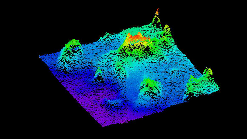
3D topographic map with colorful peaks and valleys on a black background.
Examples of point clouds of features mapped during the Beyond the Blue: Papahānaumokuākea Mapping 3 expedition, generated from acoustic data collected via multibeam echosounder. Image courtesy of Sarah Hutchinson. Download largest version (jpg, 539 KB).

Friday, November 1, 2024

Hauʻoli Makahiki Hou! During our expedition, we’ve had the privilege of learning about Hawaiian culture with guidance from our cultural liaisons, Kelsie Pīkake Kuniyoshi and Kalauʻihilani Robins. Their knowledge and passion have enriched our journey, especially as we explore Makahiki, the celebration of the Hawaiian New Year.

Video courtesy of NOAA Ocean Exploration, Beyond the Blue: Papahānaumokuākea Mapping. Download largest version (mp4, 17.6 MB)

As the constellation Makaliʻi rises in the eastern sky at sunset, it marks the beginning of Makahiki. This season, typically starting in November and continuing through late January, aligns with the rainy season and celebrates abundance through tribute, harvest, sport, and play.

In the Hawaiian calendar, the year is divided into Kauwela, the dry season, and Hoʻoilo, the wet season. The four-month Makahiki period was a joyful and festive time honoring the god Lono, one of the four principal deities in Hawaiʻi and throughout the Pacific. Lono’s domain includes fertility, agriculture, and peace, and during this time, warfare among chiefs was strictly forbidden, reinforcing the spirit of peace.

Makahiki is not only a time of rest and rejuvenation for the land and its people, but also a season to strengthen social bonds, offering a chance to renew relationships and build new ones.

Lonoikamakahiki!


Thursday, October 31, 2024

Happy Halloween from your favorite ocean explorers!
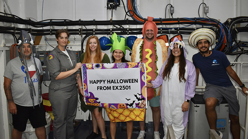
A group of people in Halloween costumes holding a banner indoors.
Happy Halloween from EX2501 (the Beyond the Blue: Papahānaumokuākea Mapping 3 expedition)! Image courtesy of Sarah Hutchinson Download largest version (jpg, 5.35 MB).
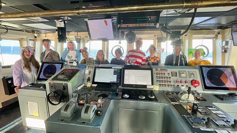
A group of people in Halloween costumes standing on the bridge of the Okeanos Explorer.
A group of festive ocean explorers gather on the bridge of NOAA Ship Okeanos Explorer in their Halloween finest during the on the Beyond the Blue: Papahānaumokuākea Mapping 3 expedition. Image courtesy of Sarah Hutchinson Download largest version (jpg, 5.66 MB).

Thursday, October 31, 2024

If you happened to be watching the live video stream this morning, you may have seen us wishing everyone a happy Halloween LIVE from Mission Control on NOAA Ship Okeanos Explorer!
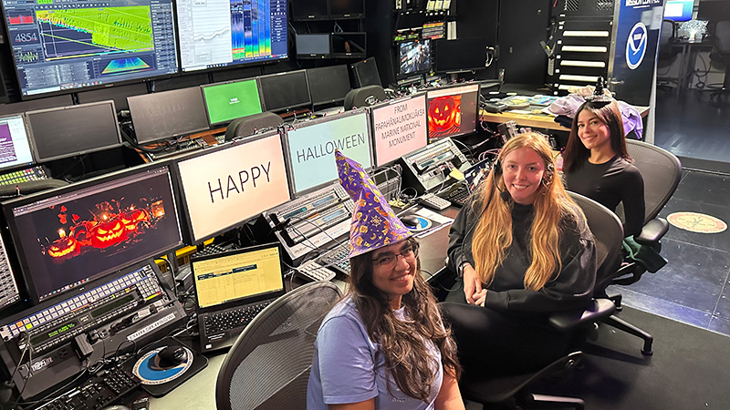
Three women in a control room, two of them wearing witch hats, surrounded by monitors displaying Halloween decorations.
Explorers-in-training on the Beyond the Blue: Papahānaumokuākea Mapping 3 expedition Prajna Jandial, Sarah Hutchinson, and Astrid Zapata-De Jesus wish everyone a happy Halloween from the mission control room on NOAA Ship Okeanos Explorer! Image courtesy of Sarah Hutchinson. Download largest version (jpg, 6.65 MB).

Wednesday, October 30, 2024

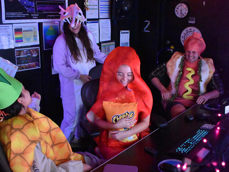
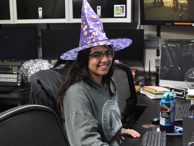
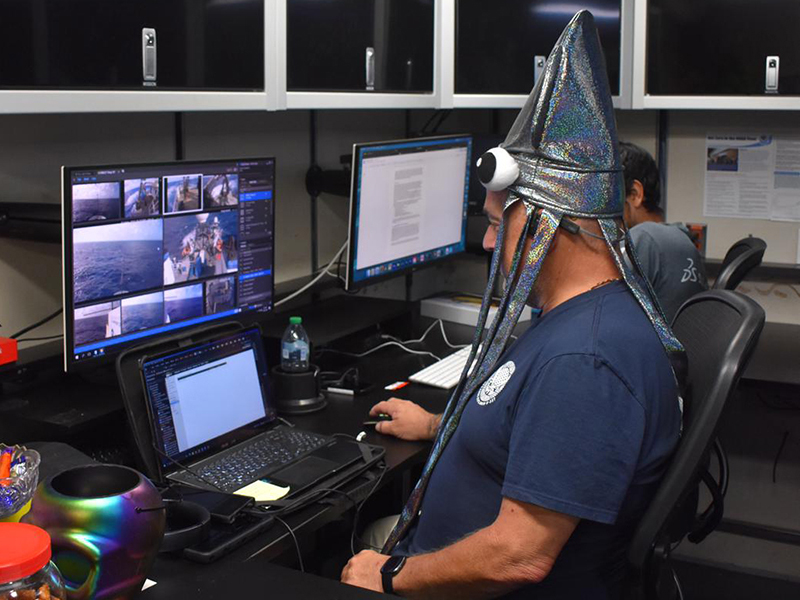
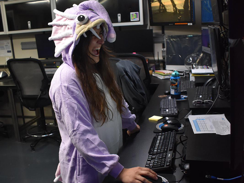
As you can see, we take Halloween very seriously on NOAA Ship Okeanos Explorer!
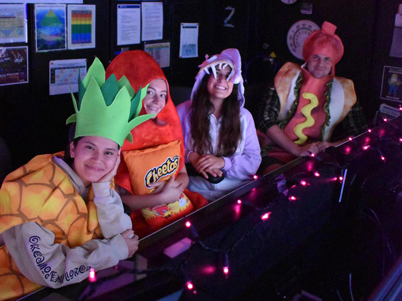
Four people in food and animal costumes in a dark room with pink lights.
Members of the Beyond the Blue: Papahānaumokuākea Mapping 3 expedition team get in the Halloween spirit in the control room of NOAA Ship Okeanos Explorer while hard at work collecting mapping data. Image courtesy of Sarah Hutchinson Download largest version (jpg, 651 KB).
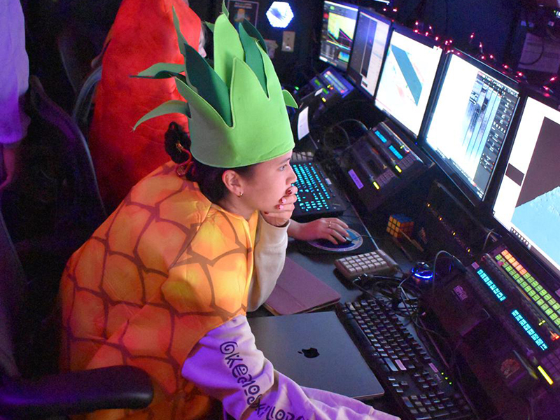
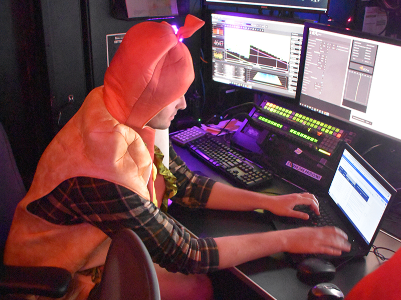
A person in a pineapple costume working at a desk with multiple computer monitors in a control room.
Members of the Beyond the Blue: Papahānaumokuākea Mapping 3 expedition team get in the Halloween spirit in the control room of NOAA Ship Okeanos Explorer while hard at work collecting mapping data. Image courtesy of Sarah Hutchinson Download largest version (jpg, 795 KB).
Four people in food and animal costumes in a dark room with pink lights.
Members of the Beyond the Blue: Papahānaumokuākea Mapping 3 expedition team get in the Halloween spirit in the control room of NOAA Ship Okeanos Explorer while hard at work collecting mapping data. Image courtesy of Sarah Hutchinson Download largest version (jpg, 752 KB).
Person wearing a wizard hat in an in the control room, smiling.
Members of the Beyond the Blue: Papahānaumokuākea Mapping 3 expedition team get in the Halloween spirit in the control room of NOAA Ship Okeanos Explorer while hard at work collecting mapping data. Image courtesy of Sarah Hutchinson Download largest version (jpg, 584 KB).

Person wearing a metallic squid hat working at a desk with multiple monitors displaying images and documents.
Members of the Beyond the Blue: Papahānaumokuākea Mapping 3 expedition team get in the Halloween spirit in the control room of NOAA Ship Okeanos Explorer while hard at work collecting mapping data. Image courtesy of Sarah Hutchinson Download largest version (jpg, 578 KB).
Person in a purple sea creature costume working at a computer desk.
Members of the Beyond the Blue: Papahānaumokuākea Mapping 3 expedition team get in the Halloween spirit in the control room of NOAA Ship Okeanos Explorer while hard at work collecting mapping data. Image courtesy of Sarah Hutchinson Download largest version (jpg, 499 KB).
A person in a carrot costume working at a computer with multiple screens displaying graphs and data.
Members of the Beyond the Blue: Papahānaumokuākea Mapping 3 expedition team get in the Halloween spirit in the control room of NOAA Ship Okeanos Explorer while hard at work collecting mapping data. Image courtesy of Sarah Hutchinson Download largest version (jpg, 9.68 MB).

Wednesday, October 30, 2024

Keeping with the Halloween theme…phantom sounds of the deep sea! Click below to hear spooky sounds from the deep.

Slow Down: Mysterious Antarctic sound, likely from a massive iceberg grounding, with its frequency dropping over seven minutes as it slows against the seafloor. Images and sounds courtesy of NOAA and NOAA Ocean Exploration. Download largest version (mp4, 1.55 MB)
Volcanic Tremors: Tremors from the Volcano Island chain south of Japan: bursts of seismic energy lasting 4-5 minutes, with 30-second pauses before the next wave begins. Images and sounds courtesy of NOAA and NOAA Ocean Exploration. Download largest version (mp4, 1.94 MB)

Bloop: “The Bloop” is the given name of a mysterious underwater sound recorded in the 1990s. Years later, NOAA scientists discovered that this sound emanated from an iceberg cracking and breaking away from an Antarctic glacier. Images and sounds courtesy of NOAA and NOAA Ocean Exploration. Download largest version (mp4, 1.09 MB)

Earthquakes: Deep cracks and rumbles from shifting tectonic plates and underwater volcanic activity. Images and sounds courtesy of NOAA and NOAA Ocean Exploration. Download largest version (mp4, 2.83 MB)

Blue Whale: The call of a northeast Pacific blue whale is perhaps the best known to date. It generally consists of two parts, A and B. The A call is a series of pulses (on the order of 1.5 pulses per second), while the B call is a long moan. Images and sounds courtesy of NOAA and NOAA Ocean Exploration. Download largest version (mp4, 1.55 MB)


Tuesday, October 29, 2024
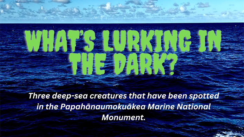
Ocean scene with text asking about deep-sea creatures in Papahānaumokuākea Marine National Monument.
What’s lurking in the dark? Three deep-sea creatures that have been spotted in Papahānaumokuākea Marine National Monument. Download largest version (png, 1.85 MB).

Did someone say spooky deep-sea creatures? While we navigate through the Pacific Ocean, we often wonder what lurks in the dark. Meet these three amazing creatures spotted within Papahānaumokuākea Marine National Monument and learn about their weird adaptations!
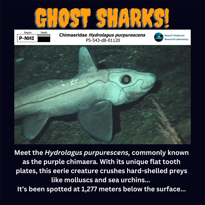
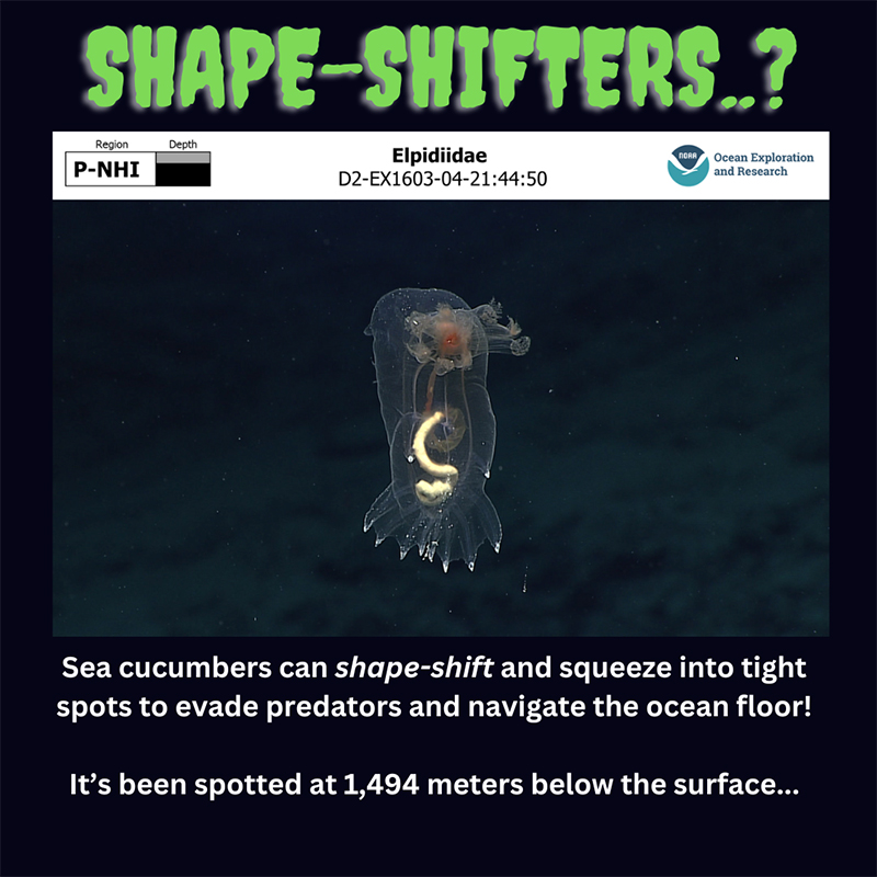
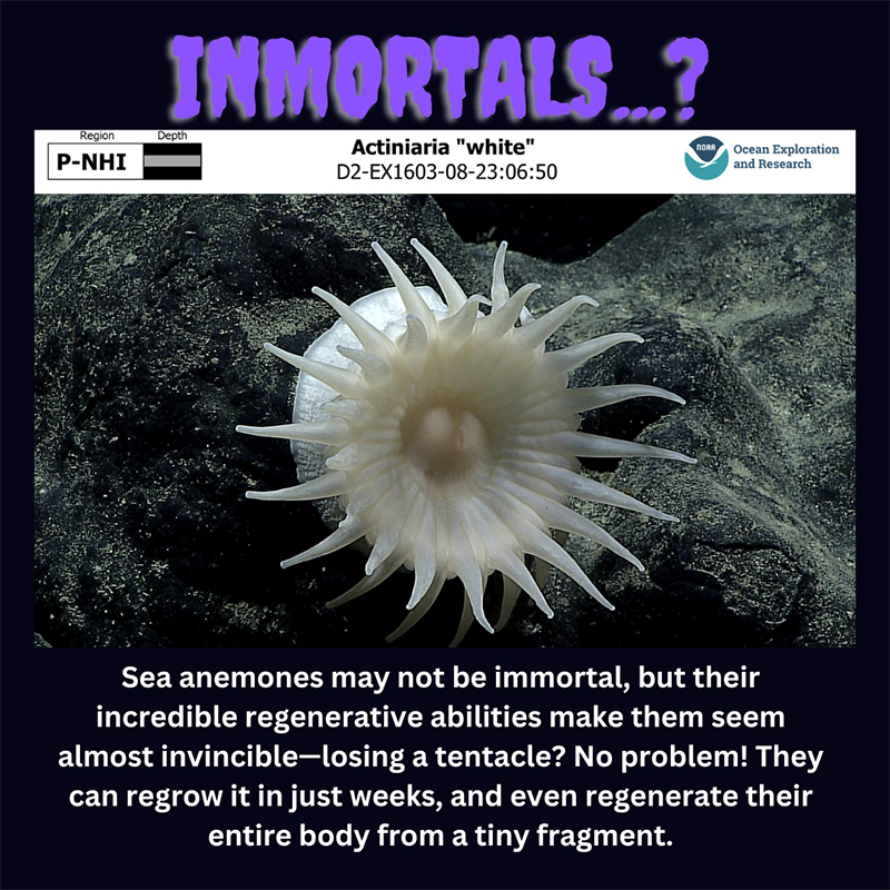
An image of a ghost shark, Hydrolagus purpurescens, swimming in the deep sea with the text 'GHOST SHARKS!' at the top.
Ghost sharks! Meet the Hydrolagus purpurescens, commonly known as the purple chimaera. With its unique flat tooth plates, this eerie creature crushes hard-shelled prey like molluscs and sea urchins. It’s been spotted at 1,277 meters (4,190 feet) below the surface. Image from the Hawaii Institute of Marine Biology, "Deep-sea creatures of the Papahānaumokuākea Marine National Monument," University of Hawaii. Download largest version (png, 820 KB).
A transparent sea cucumber from the family Elpidiidae underwater, highlighting internal structures, with text discussing its shape-shifting ability.
Shape-shifters…? Sea cucumbers can shape-shift and squeeze into tight spots to evade predators and navigate the ocean floor! It’s been spotted at 1,494 meters (4,902 feet) below the surface. Image from the Hawaii Institute of Marine Biology, "Deep-sea creatures of the Papahānaumokuākea Marine National Monument," University of Hawaii. Download largest version (png, 683 KB).
A white sea anemone with spreading tentacles on a dark underwater surface.
Immortals…? Sea anemones may not be immortal, but their incredible regenerative abilities make them seem almost invincible–losing a tentacle? No problem! They can regrow it in just weeks and even regenerate their entire body from a tiny fragment. Image from the Hawaii Institute of Marine Biology, "Deep-sea creatures of the Papahānaumokuākea Marine National Monument," University of Hawaii. Download largest version (png, 1.23 MB).

Monday, October 28, 2024
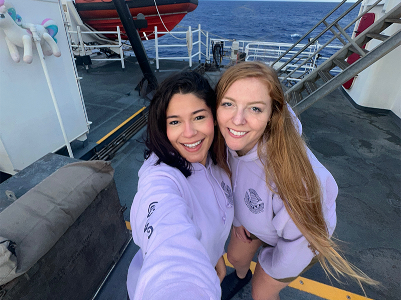
The image shows two smiling women standing on the deck of a ship, with the ocean visible in the background. Both are wearing light purple hoodies with logos and have straight hair; one has dark hair, and the other has light brown hair. Behind them, a red inflatable boat is mounted, and a set of stairs leads up to another level of the ship. To the left, a white container with a plush toy, resembling a unicorn, is partially visible. The decking is dark grey, with yellow and white lines marking pathways.
Explorers-in-Training Sarah Hutchinson and Astrid Zapata-De Jesus on NOAA Ship Okeanos Explorer. Image courtesy of Astrid Zapata-De Jesus. Download largest version (png, 10 MB).

Hello everyone! We are Sarah and Astrid, Explorers-in-Training on NOAA Ship Okeanos Explorer! Follow along on our journey as we spend the next few weeks mapping the unknown seafloor in Papahānaumokuākea Marine National Monument.


Published October 28, 2024
Last Updated October 29, 2024